
An offline-first mobile app and sync backend for carbon project field data. Surveyors register farmers, capture consent, map parcels and run monitoring rounds with no signal. Supervisors review every record before it counts.
Most field tools save every visit as a separate form. The baseline survey in March, the consent in April and the monitoring visit in October never meet, and the evidence trail breaks before a verifier ever opens it.
Carbon Field starts from a registry instead. Every farmer gets one record, and every stage of the project hangs off it: who they are, what they agreed to, where their land is, and what changed on it, round after round.
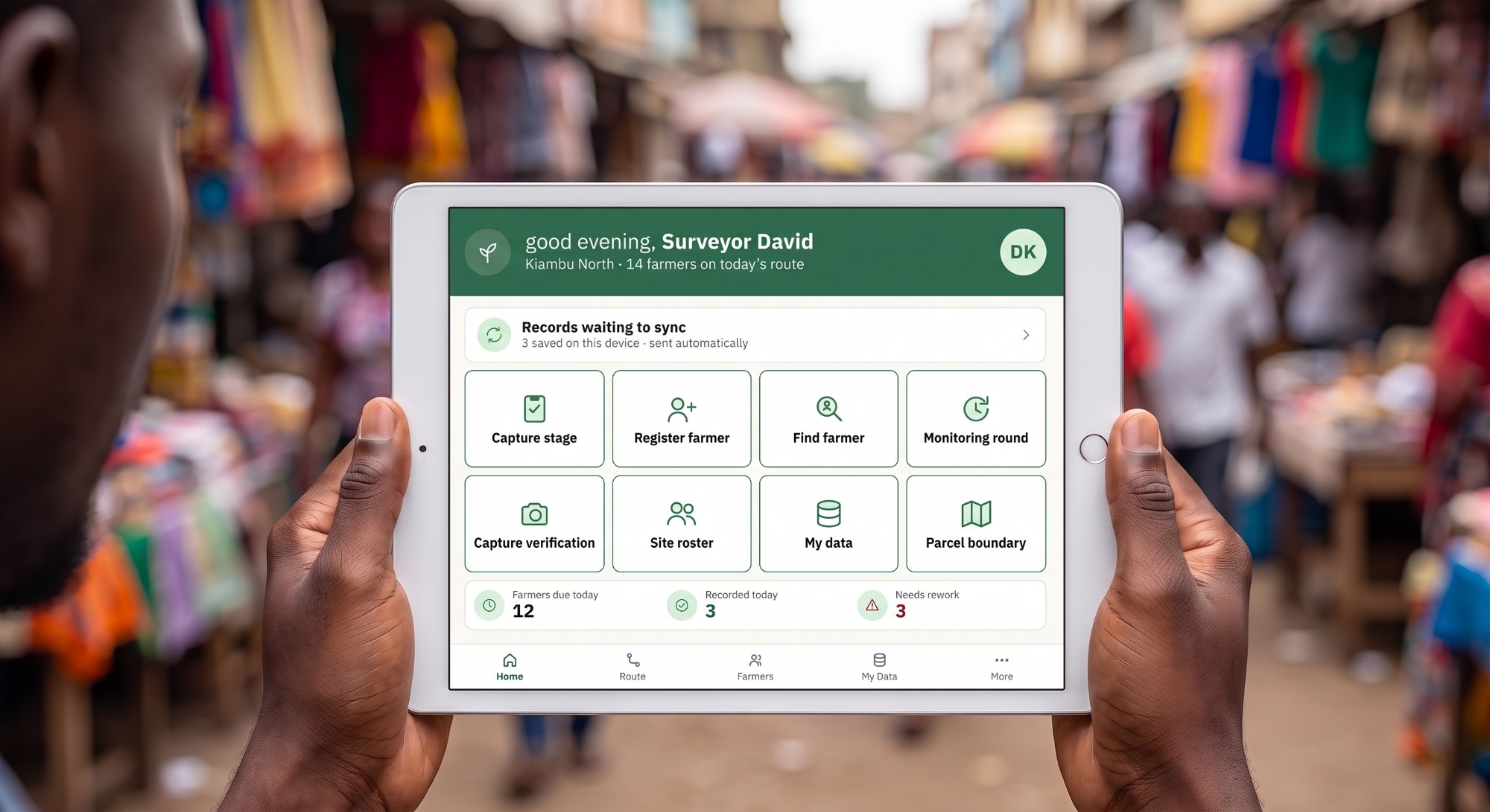
Screens from the current tablet design. Names and numbers shown are sample data.
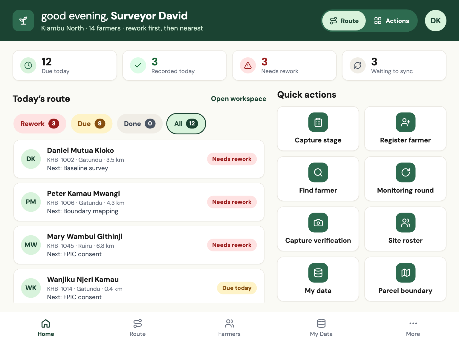
Who needs a visit, what is due, what came back for rework and what is still waiting to sync. Rework comes first, then the nearest farmer. A surveyor who prefers big action buttons can switch the layout in one tap.
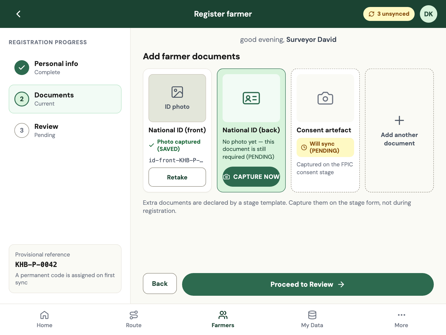
Personal details, ID photos and a GPS homestead point, on a guided three-step rail. Each document tile says plainly whether it is saved, pending or still needed. A duplicate check compares name, village and distance before a second record can be created.
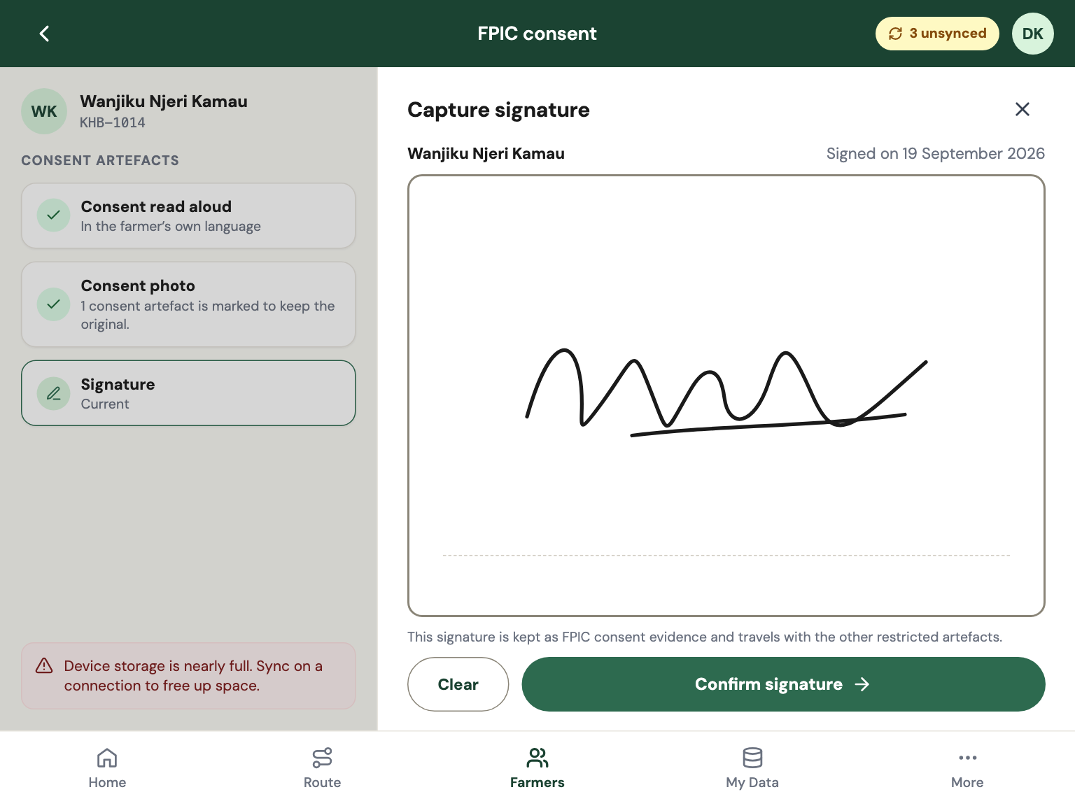
Free, prior and informed consent is captured as a signature and a photo, dated, tied to the surveyor who witnessed it and kept with the project's restricted artefacts. A site can hold later stages until consent is approved.
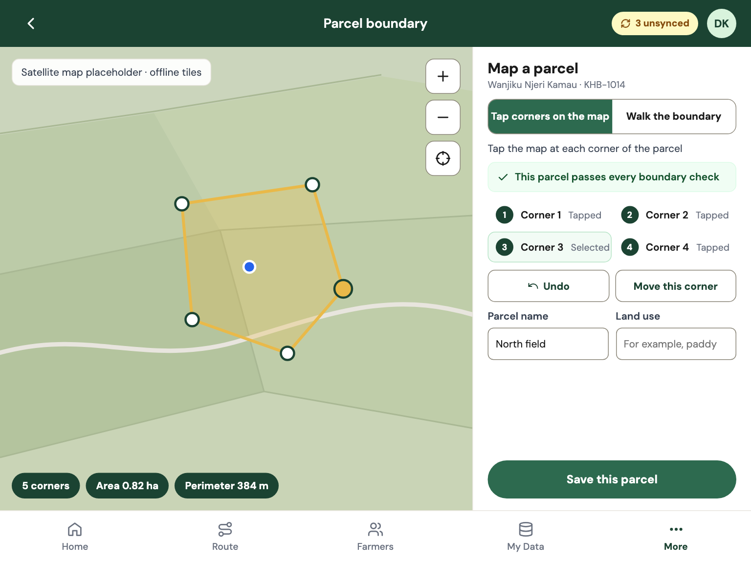
Walk the edge or tap the corners on an offline map. Area and perimeter update live, and the shape is checked as it is drawn: no crossing edges, at least three corners, an area inside the site's limits. Parcels export as GeoJSON and KML for QGIS and Google Earth.
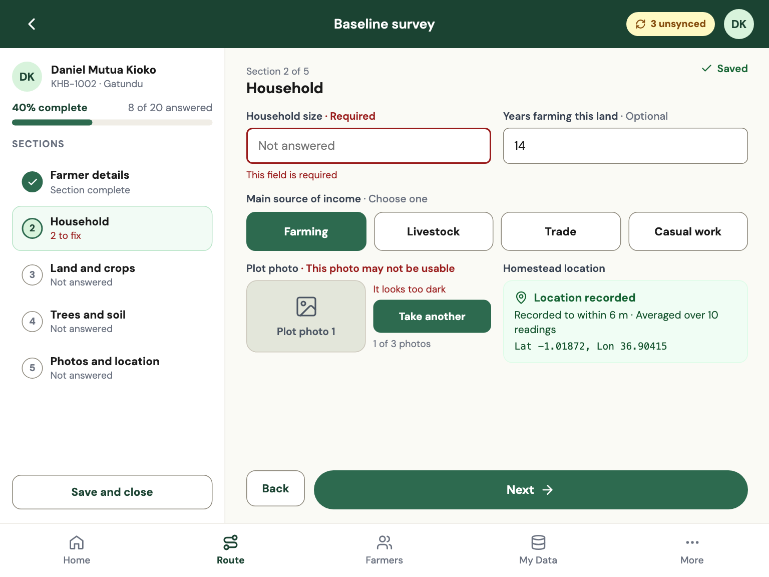
Each project defines its own questions. The app checks required answers, photo quality and location accuracy as the surveyor works, in plain sentences rather than error codes. Drafts autosave and resume exactly where they stopped.
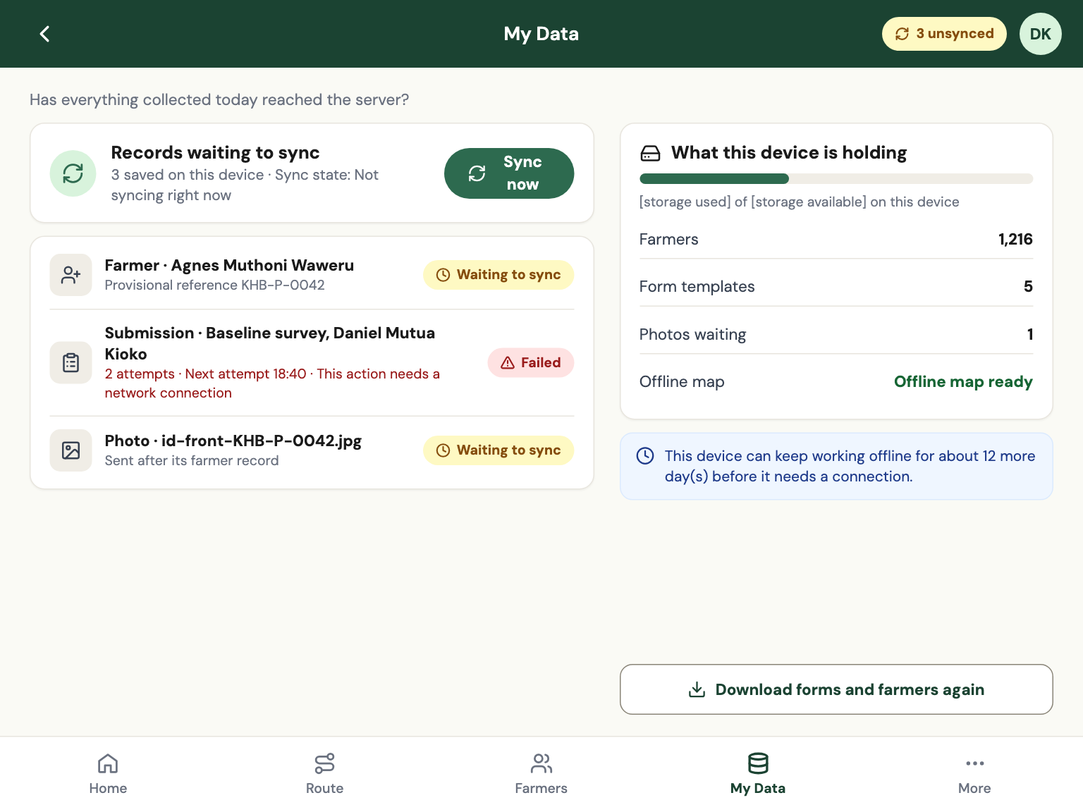
Every record is saved on the tablet first and queued. Sync runs automatically when a signal appears, retries on its own and says in plain language what is waiting, what failed and why.
Baseline survey, FPIC consent, boundary mapping, implementation and monitoring, in the order the project runs them.
Each round is its own submission. A round that has been sent cannot be quietly re-opened.
Readings are averaged and held to a 10 m gate. Anything worse is flagged, never silently accepted.
Blurred, too dark or too bright photos are caught at capture, with the reason in a sentence.
Similar name, same village, nearby homestead. An override needs a written reason.
The interface and the forms switch language on the device.
Mock locations and modified devices are flagged for review. They never stop a surveyor working.
Review queue, farmer timeline, site map, exports and an audit trail. Approve, or return with a reason.
Map tiles for the site download once, with a size estimate first, and work without a connection.
One codebase for the web app and the Android and iOS shells, with a sync backend designed for weeks of queued work.
A web app wrapped for Android and iOS, with native bridges for camera, GPS and secure storage.
Everything is written to an on-device database first. The network is never in the way of saving.
Postgres with row-level security. Sync endpoints for farmers, submissions, media and changes, safe to retry.
A container-based deployment kit, so a project can run the backend on infrastructure it controls.
Carbon Field is in active development. Here is what is built, and where partners come in.
We are looking for partners, sponsors and critics for the development of the mobile app and its backend. Tell us what you would bring: devices, funding, maps or technology.
Four kinds of partner. Registered partners get the full field-data playbook.
Fund a named milestone.
Tell us what we are getting wrong.
Five stages, four evidence rules and one review loop. To download it you register first, as a partner, sponsor or reviewer, with a pre-written email.